Activity
Africa GIS Web
Project description
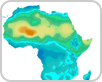
In January 1999, GRID-Geneva and UNITAR launched a joint undertaking to make environmental information in the form of dynamic maps more widely accessible to users through the use of electronic media, namely the Internet and CD-ROM. A software program application, called “GISWeb-Africa”, was developed to create dynamic maps and related GIS databases on Africa’s physical environment.
The former website http://maps.grid.unep.ch/scripts/esrimap.dll?name=gisweb&cmd=map does not work anymore.