Resource
Impact on aquaculture
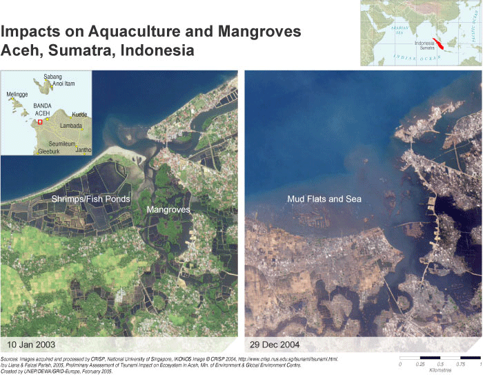
Description
These images show a close-up view of the northern coastal area of case study 1. Features include a swampy coastal strip of land which has largely been converted to tambak. Part of the inland estuary is covered in Rhizophora mangroves, which are important spawning and nursery grounds for the milkfish and prawns traditionally raised in the tambak ponds. Further tambak ponds are located inland on the estuarine system. The post-tsunami image shows the devastating effect of the tsunami on the low-lying lands. The force of the water is able to travel up estuarine systems, often up to 6 kilometres inland. The western strip of coastal sandbar has been completely removed and tambak ponds destroyed, along with the majority of the mangroves. Clearly, a vast volume of material was carried out into the ocean. Devastating effects on housing infrastructure are also evident.