Resource
Tracking Land-derived Pollution by Satellite in the Eastern Mediterranean Sea
Description
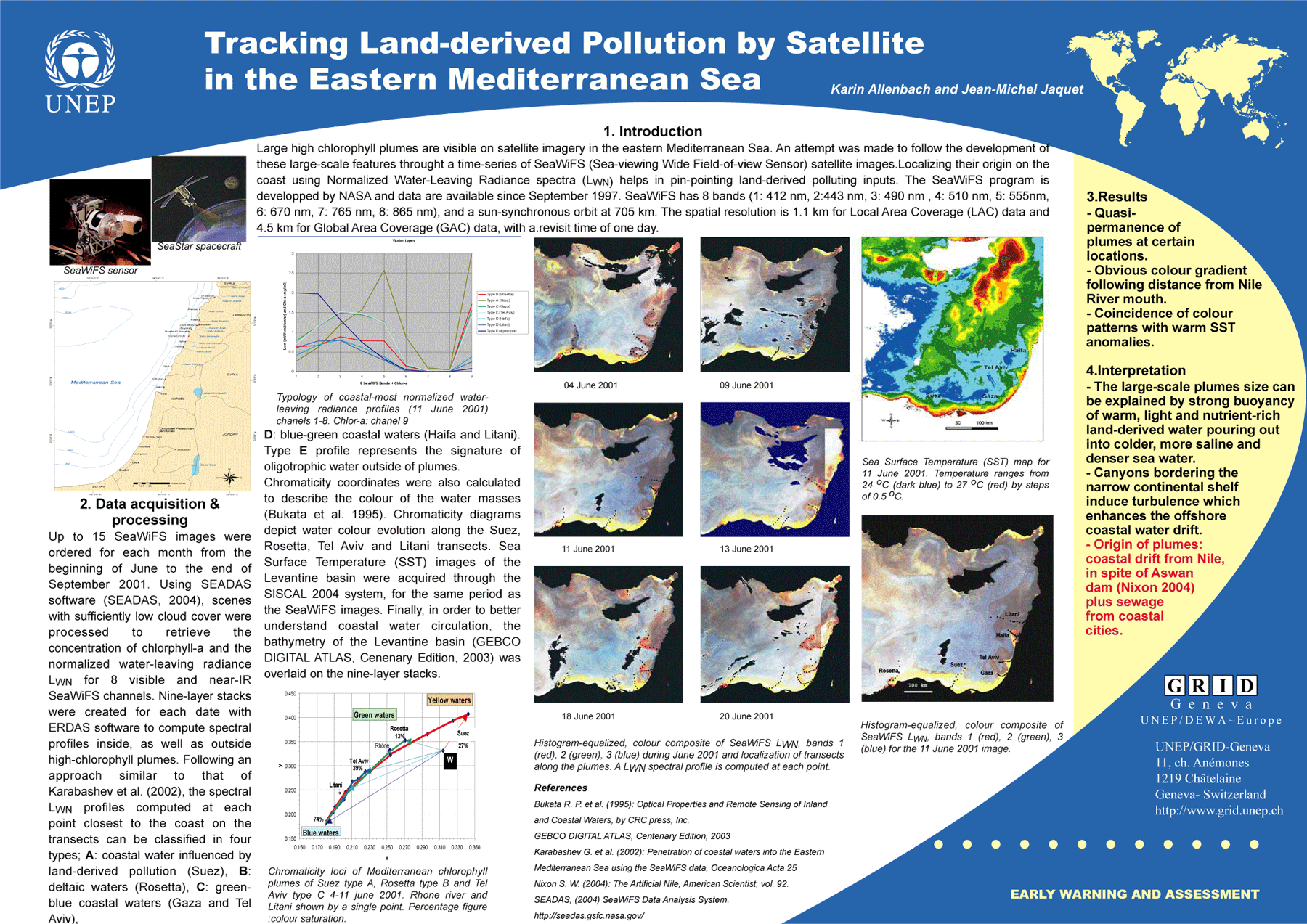
Large high chlorophyll plumes are visible on satellite imagery in the eastern Mediterranean Sea. An attempt was made to follow the development of these large-scale features throught a time-series of SeaWiFS (Sea-viewing Wide Field-of-view Sensor) satellite images.Localizing their origin on the coast using Normalized Water-Leaving Radiance spectra (LWN) helps in pin-pointing land-derived polluting inputs. The SeaWiFS program is developped by NASA and data are available since September 1997. SeaWiFS has 8 bands (1: 412 nm, 2:443 nm, 3: 490 nm , 4: 510 nm, 5: 555nm, 6: 670 nm, 7: 765 nm, 8: 865 nm), and a sun-synchronous orbit at 705 km. The spatial resolution is 1.1 km for Local Area Coverage (LAC) data and 4.5 km for Global Area Coverage (GAC) data, with a.revisit time of one day.