Resource
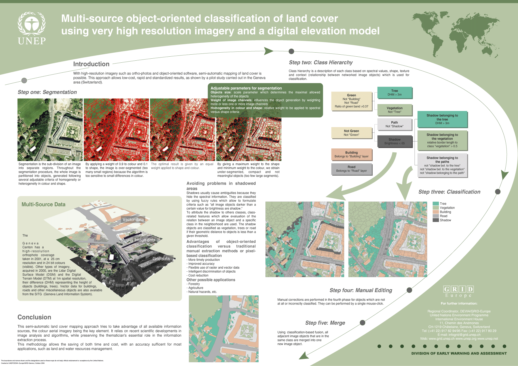
Multi-source object-oriented classification of land cover using very high resolution imagery and a digital elevation model
Description
With high-resolution imagery such as ortho-photos and object-oriented software, semi-automatic mapping of land cover is possible. This approach allows low-cost, rapid and standardized results, as shown by a pilot study carried out in the Geneva area (Switzerland).
